

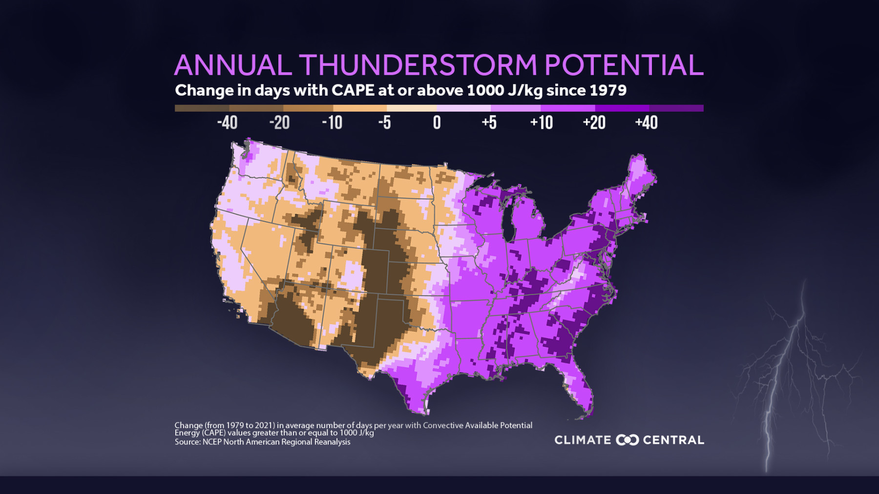
Severe weather - thunderstorms which include tornadoes,damaging wind, and/or hail - account for nearly half (47%) of the 323 billion-dollar weather disasters that have impacted the U.S. since 1980. This week, we look at how one key indicator of thunderstorm severity - Convective Available Potential Energy (CAPE) - has changed with recent warming.
Thunderstorm severity is a sliding scale. Warm, rising air is central to the formation of thunderstorms. The amount of energy available for this rising air is called convective available potential energy (CAPE). Higher CAPE values mean more energy available to move throughout the atmosphere, and thus greater potential for thunderstorms.
Severe thunderstorm potential is highest in spring—and getting higher. To understand how thunderstorm potential has changed with rising temperatures, Climate Central analyzed trends in CAPE values across the U.S. from 1979 to 2021.